Water seems like such a crazy thing to be contemplating in the middle of the winter, as we are wholly surrounded by it but so far away from the re-emergence of its more fluid form. But the topic of water is on the docket in this week’s permaculture class, and as such, it’s on my mind!
Interior Alaska seems like a hydrologic wonderland in the summer, with endless bogs and lakes, large sinuous rivers, and afternoon rainstorms. Despite appearances, Fairbanks actually exists in a subarctic “desert”, with much of this surficial water perched on frozen soils and bedrock. According to the Alaska Climate Research Center, Fairbanks receives under 11′ of rain annually, on average. For comparison, Santa Barbara (where I lived before I moved to Alaska) receives just under 18″ annually. Santa Barbara is located in southern California, and turns totally brown in the winter and is subject to raging wildfires. My well in Santa Barbara would regularly go dry because there just wasn’t sufficient groundwater recharge at certain times of the year.
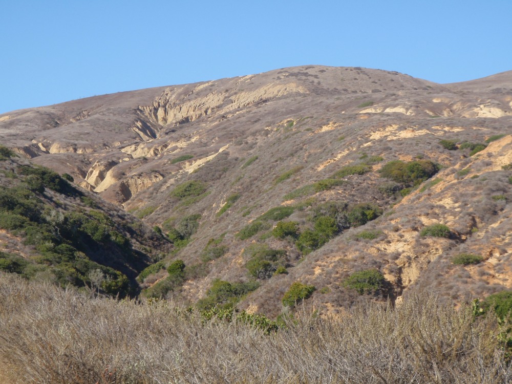
This is Santa Cruz Island, just off the coast of Santa Barbara in September.
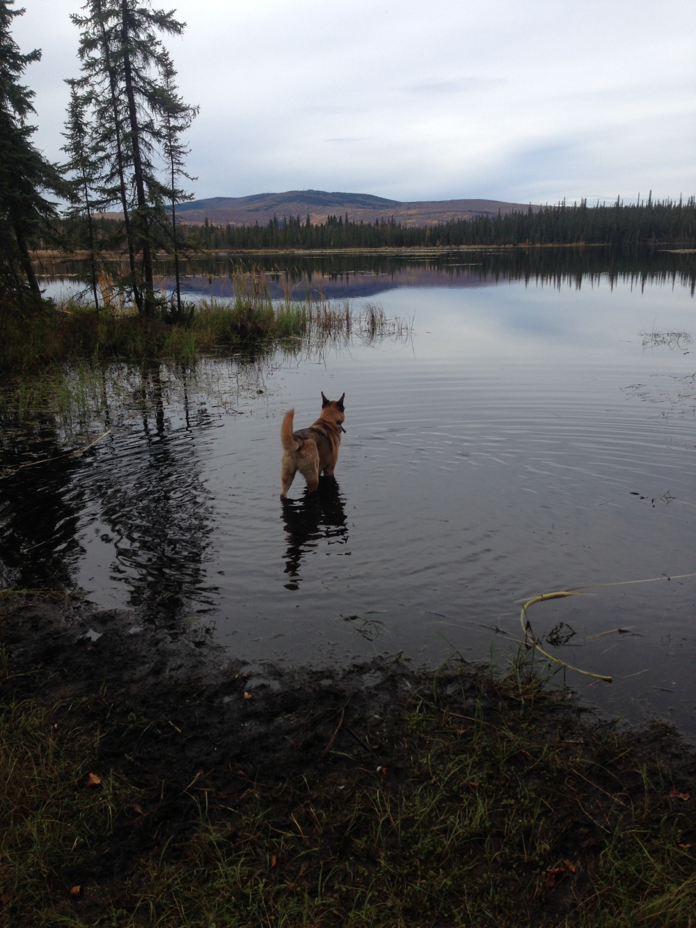
And this is Interior Alaska in September. Mind blowing, isn’t it?
Regardless of how lush it feels around here, it’s still crucial to save water. Our property is perched up in the hills, with a well reaching deep into the bedrock towards the water table. It behooves us to keep as much water up at the top with us as we can, since wells are expensive and they don’t last forever, depending on the fluctuations of the water table. And bringing that water up from the depths with our electric pump isn’t the most efficient thing in the world, either.
Independent of our own concerns, conserving water is a real serious business, and sooner or later we all will be forced to use less. So might as well get used to it before it becomes a hard necessity!
One of the mantras for water is ‘slow it, spread it, sink it’. The idea is to capture as much water as possible on site, spread it over the site where it is needed and to reduce destructive energy, then let it seep into the local water table. This is achieved in a number of ways, but one of the most iconic is using swales along contour lines and storing water high in catchment ponds, allowing for gravity dispersion. This technique is used most readily in areas with moderate topographic relief, such as the sides of hills. Since it is such a cool idea, I am tempted to try it a little here on my property. Though our land is mostly flat, I did notice earlier today that there is a considerable asymmetric slope – highest at the road, and lowest towards the east edge of the property.
While I’ll need to do some proper contour surveying this spring/summer (when I can see the ground!), here’s a stab at how this technique could begin to be applied at my property.

The blue field on the western margin represents the range of possibilities for placement of a collection pond, and the arrows represent paths the water could take to reach a small garden plot next to the greenhouse, and the proposed main garden section next to the cabin. Since there is no real runoff problem here that I have noticed – we have mossy areas surrounding the whole cleared zone – waterworks will probably be constrained to planting areas and livestock areas. We’ll see!
